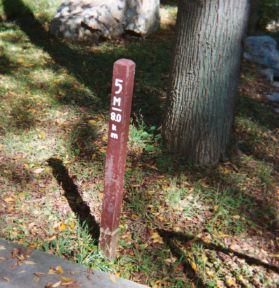
Milepost 5 of Rock Creek Trail is at the end of a small bridge over a minor tributary of Rock Creek, almost midway between the trail crossing of Cedar Lane and the point where the path turns away from the Beltway to cross Beach Drive and enter the woods of Kensington. (The shadow of the bridge railing is visible in the photograph.) This part of the trail is within the noise penumbra of the Capital Beltway. An all-weather water fountain and a porta-john are situated at the playground just to the west of Cedar Lane.
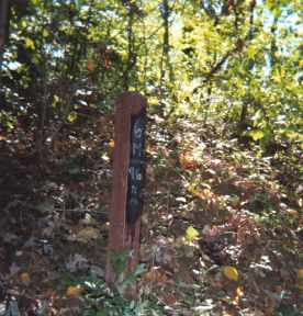
The trail diverges here from Beach Drive and from the channel of Rock Creek itself, to pass through a pleasant and at times thickly wooded area behind the back yards of a residential neighborhood. Milepost 6 is in the midst of this forested zone. Side trails offer access to/from Parkwood Drive and other local streets. Some of the slopes in this section of Rock Creek Trail are moderately steep and offer runners an opportunity for good "hill work".
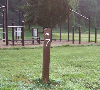
After crossing Knowles Avenue (a busy street – beware!) Rock Creek Trail goes through a tunnel under the C&O railroad and then enters Ken-Gar Park. A good all-weather water fountain is next to a park building and some playground equipment here, and a porta-john is placed at the nearby parking lot. After curving between basketball courts, soccer fields, and tennis courts, the trail passes Milepost 7 (see exercise equipment in the background of the photo) and proceeds northward, generally parallel to Beach Drive, through woods and gently rolling terrain.
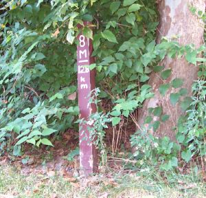
Beach Drive ends at Garrett Park Road, where the trail continues north near baseball fields and another rec center (a water fountain, not always working, is on the side of the building). The path then curves down through a frequently boggy and flooded area, one of the muddiest zones along the entire 14 mile length of Rock Creek Trail. After a long and somewhat steep climb it arrives at Dewey Park, where Milepost 8 is located at the corner of a parking lot driveway. A water fountain near the tennis courts sometimes functions. The trail next returns to a woodsy area, with several side pathways branching off to nearby neighborhoods.
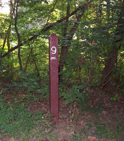
Rock Creek Trail emerges into an open field as it approaches Randolph Road, an extremely busy street (danger! – it is wise to use the official Dewey Road traffic light crosswalk). North of Randolph the trail curves between and among soccer fields until it approaches a parking lot, where a good all-weather water fountain is located. Here a deceptive side trail continues straight past the parking area. Rock Creek Trail itself zigs sharply west to cross a small bridge over the stream, then zags north again up a slope into the beginning of a hilly and well-forested zone. Milepost 9 is placed at the start of this challenging region of long, steep rises.
See DC Metro Area Trails: GPS Waypoints for a zoomable map showing the locations of GPS waypoints taken by ^z at every milepost along Rock Creek Trail, plus landmarks on other hiker/biker/jogger trails in the metropolitan area. Note that some map links in the image descriptions above have been tweaked to correspond to true milepost locations as depicted on Google Maps.
(photos taken by MarkZimmermann along RCT; cf. RockCreekTrail (31 May 2002), GoogleMapExperiments (11 Sep 2005), Rock Creek Trail Miles 0 to 4 (26 Sep 2005), ...)
TopicRunning - TopicRecreation - TopicPersonalHistory - 2006-01-16
(correlates: Rock Creek Trail Miles 10 to 14, Rock Creek Trail Miles 0 to 4, HalfwayPoint, ...)